Tuesday, 12 February 2013

A Virtual Tour of Teotihuacan


             For this week’s blog entry, I will be taking a virtual tour of the fascinating city of Teotihuacan. When taking this walk through Teotihuacan I will be focusing on the pyramids as well as the Street of the Dead Complex. Between these two fascinating uses of space and pieces of architecture, I hope to learn more about what they are and get a stronger idea about the themes involved.  

            To begin, I will be looking at the Pyramid of the Moon. This pyramid, which was once home to two tomb sites, was built in six stages, each stage building up onto the original structure.  One of the tombs found four people, while the other tomb was found to be the tomb of the great Goddess, whose statue was said to have mounted this great structure at one point. In addition to being a place that emphasized power over the area, it is also quite large in structure. It is the second largest structure in Teotihuacan. Also, it was created with an artistic nature in which its appearance resembles the mountain Cerro Gordo which is nearby. When staring up at the pyramid, the overall dominant size allows me to see it conveyed power over the city. Most importantly to me, I loved the contrast between the architecture and the physical environment around it. It tells me a story about how they adapted to the landscape.

           
           As I continue on my journey through Teotihuacan I arrive at the Pyramid of the Sun. This pyramid is the largest structure in Teotihuacan. This pyramid is the third largest in the world, and it is located in the middle of the city showing its centrality and importance. Looking at it I can feel the presence as it towers above me intricate and defined. The pyramid looks as if it has been weathered and brutalized with the passage of time, but researchers said that an alter used to be solidified on top which means that this place probably stood for religious and cultural purposes in the area. Also, this pyramid was created strategically so that astrological events could be monitored, as well as the monitoring of the agricultural practices of the time. This pyramid was also said to have been a tomb, but due to the destruction of it over time, and lack of intensity in the excavations, it is unknown.

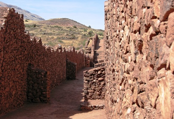
           After looking at both of these pyramids, I am able to see that they have religious importance, but they also control the theme of power. Standing tall with such centrality in the city, these pyramids look over the city and show the citizens who is in power. The grid like pattern of the city around these structures is also important because it shows how the space was organized like a hierarchy in which the elite lived near the center and the less fortunate on the fringe. This is a very similar characteristic to what I found on my last trip to Timgad and Pikillacta.

Finally, I walked to the Street of the Dead Complex. This complex is one of the most recognizable places in Teotihuacan and was known for its large courtyards in which rituals were performed.  The open space between the two compounds on either side of the street, allows for a very open feel. When looking at the areas, they look like the perfect spaces for people to come together, which proposes the possible theme of unity and community. This place was also noted for most likely being the place for administrative work and residences. It also acts as a division between the two other areas of the city, suggesting the themes of power, space, and colonialism.
 

            Overall, as I look at the whole city, it is fairly easy for me to see the results of dual rulership in the architecture and in the use of space. I think Teotihuacan is actually beautiful in the way the city contrasts the mountains in the background, and I find that the architecture shows meaning with respect to the culture and the physical environment. I am able to see many similarities here to other places I have visited such as the pyramids in Egypt, and the grid pattern in Timgad which allows me to understand that these urban trends defining cities have made their ways to different cultures. That is it for Teotihuacan, stay tuned for my next tour!

Wednesday, 30 January 2013

Timgad vs Pikillacta


For this week’s blog post I will be looking to compare two incredible examples of colonial architecture, and evaluate them on their use of space and place, as well as the cultural and social impacts of the architecture on the area. The two places I will be looking at are the Roman colonial center of Timgad and the Wari military center of Pikillacta. As each of these centers were built on the frontiers of their respective empires, a strong analysis should be able to tell us how they are similar, and in what ways they differ.

To begin, the Roman colonial center if Timgad is located on the Northern Slopes of the Aures Mountains, in modern day Algeria. Timgad was known for being a military settlement at the time of its founding by Trajan. Timgad is now important today because it is mostly recognized for the grid pattern planning characterized by large square blocks with 90 degree intersections. This is significant because when I was looking at the area on Google Maps, it appears extremely planned which is extremely different from how Rome was organized, which was mostly organic. Timgad itself consists of 144 blocks, evenly divided into four main areas, but the Forum and the theatre take up 11 and 6 blocks respectively. This area looks fascinating as when developed it looks like it was created to manipulate the landscape. I believe they did this for a few reasons. One, with greater organization it would control the flow of people and be more mathematically precise in organization. Also, the grid pattern is important because the emperor would live in the middle which shows how this space represents a hierarchal structure. As you move out from the middle, the class of people declines. By seeing how much room these places occupied, it shows the importance that size and space played in this area. In addition, with precise grid like divisions, it shows me the importance that organization and structure played into the social and political values of the area. This is vital socially, because as a person in a town you want to maintain the appearance of who you are and keep the cultural dynamics of the area constant. Finally, another observation I made when looking at Google Maps is that the walls in Timgad seemed smaller than the ones in Pikillacta. This suggests to me that the area had walls as a mechanism for defense, but due to the smaller walls, it was not the only purpose. Also the smaller walls allow for a more open concept which is a different use of space.

 
After viewing the important features that Timgad had to offer, I looked at the Wari military center of Pikillacta. Pikillacta is located in the Lucre Basin of Peru at the east end of the valley of Cuzco. When Pikillacta was developed it was designed to appear different from above as it was seen from the ground. From an aerial view Pikillacta looks as if it is built on a flat landscape, but in reality from a ground view is built on a slope with nearly a 100 meter elevation difference in certain parts. When looking at the form of the structures, Pikillacta places a large emphasis on the grid pattern as well, and uses rectangles and squares to determine how they allocate space. Pikillacta is often described as bellicose and regimented. From the very large walls dividing the area into a grid pattern, it is easy to see that this area was a military outpost. Based on my observations again, it looks as if it was built on a hierarchy of space, having only specific ways to get to the middle where the elite lived. I am starting to see a need in military structure to build the mass tight and in control grids, for organization but also strategic defense. The terrain is also very uneven which would make for better defense. I believe that this use of space and architectural design is used for intimidation, defense, power, and attractive organization. Finally, due to its transparent structure, you are forced to walk through it in certain ways which could lead to one thinking that is was also designed for administrative purposes.

As you can see from the comparison of the two places, they are similar in the respect that they are both military centers, they both have a grid pattern that shows a hierarchal use of space, they both have walls for defense, and they both manipulate the land in which they are upon to create a symmetric land use that is appealing yet strategic socially, politically, and from a military aspect. The differences between the two are that in Pikillacta the walls are very large suggesting that this was a major military base and that the use of space is more condense and tight in formation, while in Timgad the walls are smaller which allows for the space to seem more open in concept. Therefore, I have found after another exploration on Google Maps the similarities and differences that exist between Timgad and Pikillacta.


Wednesday, 23 January 2013

A Walk Through Rome


As I begin my journey throughout this blog, it will begin with an understanding and a virtual journey through Rome. Rome is currently a popular tourist destination due to the incredible architectural sites, and is an important place to look when understanding the evolution of architecture and its involvement in the world today. As I go through the virtual tour on Google Maps, I will be using a travel guide found on www.rome.info, to view and analyze architectural sites that have been preserved and revitalized, as well as take a look at the space and how it is used in Rome. With all that being said, let’s begin our walk through Rome!
As I begin my walk, I start at the remarkable Pantheon. The Pantheon is the most preserved building of ancient Rome. Orginally built between A.D. 118-125, it was a temple dedicated to the gods of Rome. As I look at the building itself, it is fascinating how the front is rectangular allowing for the classic entranceways for precessions, but also that it is combined with a massive circular back, showing how the Roman architecture played with geometry to seek architectural success. The building would have originally been entered by climbing a set of stairs at the front, but has now been restructured so that the stairs are underground.  One of the fascinating things I am able to learn here is that due to the buildings incredible size, when building, heavy materials such as travertine and brick were used for a solid base, but for the dome, pumice a very light material was used for a sufficient and efficient enclosure. Finally, I am able to see that the structure is not Doric, which shows that there may have been a more feminine and artistic appreciation in the design of this great piece of work. Beyond the structure of the building itself, it is interesting to look at the modern design of the streets and space around the building. The Pantheon appears to be the center of importance for the area, which shows a dominant power characteristic for the gods. As for the space around the Pantheon, out front there is an open space which allows for the Pantheon to stand alone, powerful and dominate the area. As for the streets around the Pantheon, they are very narrow which shows that the area is very dense. Although dense, none of the buildings around the Pantheon are nearly as large, which shows how much larger the Pantheon is in comparison to the rest of the area, again showing the dominance and power of those who use the building. Therefore, after my virtual tour of the Pantheon I am able to see what makes it unique to Rome, and how its placement and use of space allows it to stand as a powerful landmark.
 
The next stop on my tour is the Roman Forum. The forum  is the central area in which Anicent Rome developed. This is the area where the day to day activities occurred such as finances, administration, religious events, and was known as the hearth of the city. This area was home to the most important public buildings and structures such as the Arch of Titus, the Temple of Saturn, and the Temple of Vesta.  If you look at the area and the space in which the Forum is located, it is in a central location which shows the power of the area and the central importance of the Roman civilization. It is also very unique to see how the Forum is separted from the area around it by walls which shows again the power that existed in this central area. As for the architecture, the exquisite stone arches and columns stood strong at one point, but after being destroyed the Forum is not as beautiful as it once was. Although destroyed, it is important to note the importance that archways, and columns played in the area, and how the precision to detail on these architectural monuments is just phenominal. Overall the Roman Forum stands as a central point for the citizens of Rome, and although it has changed significantly now in present day, the significance of its location and space it occupies is largely significant of the time period.
Finally, to finish off my virtual tour I took a walk around the Roman Colosseum. The Colosseum is located just east of the Roman Forum and was built in A.D 80, originally known as the Flavian Amphitheatre. This colossal structure was home to the famous gladiator fights as well as other cultural events of the time. The amphitheatre could hold over 50 000 people showing its dominant size and influence. The main features that I can see from this this great structure is the abundance of arches that act as elegant and precise entranceways, as well as masts that were attached to stone corbels on the fourth level. When looking at the space around the Colosseum there is a lot of open space which allows the structure to look even larger in size than it already is. In addition, the open space is nice because it reminds me of modern day sport stadiums that have an area outside where fans gather, and I feel the space gives a social identity to the area. Finally, by standing tall and alone over the open space, the placement allows for a powerful image for the structure, which was one of the main themes found in Roman Architecture.
Therefore, after completing my virtual tour through Rome, I am able to see the intricate designs and forms of some of the most notable structures, but at the same time I am able to see how their placement and use of space emphasizes their importance in the area. The narrow and winding streets in Rome shows the organic design of the city as a whole, and the elevation changes really gives Rome a confusing nature to travel around. But overall, Romans used space, place and architecture to create the incredible place that we now tour and study today.

Hello classmates, bloggers, and friends:

My name is Robert Richards and I'm currently a 3rd year student at the University of Western Ontario, enrolled in the Honours Specialization of Urban Development program. Beyond my undergraduate degree, I will work towards obtaining an MBA in Finance, to pursue my dream to be a financial research analyst. Born and raised in Whitby, Ontario, I have seen firsthand the evolution of Whitby from a small town, to a large urban town on the verge of becoming a city. This environment is one of the main reasons why I have found a passion in urban development, and one of the reasons I have found an appreciation for the urban form. At school I have been lucky enough to be the Finance Executive for the Urban Development Association. This opportunity has given me more insight into the diversity that urban form brings to the world and the opportunities that exist today. With the combination of a drive from an early age, and the tools at the University level, I hope to continue my learning as I dive into the artistic nature behind architecture and urban design.
This blog that I have created will explore not only the history of architecture and urbanism, but it will also involve my insights, beliefs, and critiques of the evolution of the urban world. Throughout the semester, I will be discussing a variety of themes, ideologies, and opinions pertaining to VAH 3388G, hoping to stir conversation about issues with my classmates and friends.
Now that you know more about me, let me use a new urban trend to tell you more about me as an individual.
As a student fascinated with urban design, I have much to learn about architecture from the past as I have never taken an architecture class before. As for my current interests, I am a big supporter of green architecture. This green form transforms how many look at cities, and although not feasible in a variety of aspects, the natural beauty and the social benefits from the environmentally friendly mindset make this urban feature appealing.  The main feature that I like is the use of green roofs. By placing greenery on top of buildings it is appealing for one, but is also reduces the heat on the city which is a very interesting effect in my opinion. A great example is City Hall in Chicago who has taken the green roof to heart and has become a model for the integration of the environment into the urban form.
I look forward to discussing future topics with all of you!